Vietnam Releases Partial Result of Spatial Database of Its Seas and Islands

A three-year project of Vietnam to monitor its marine and island environmental resources has yielded an initial result of a database containing multi-temporal spatial images of the country’s territorial waters including the archipelagos of Hoang Sa (Paracel) and Truong Sa (Spratly).
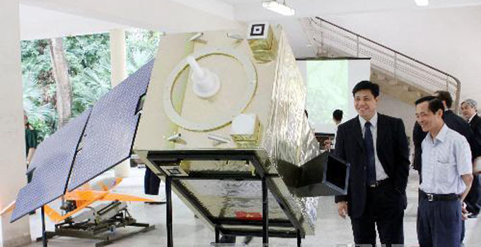
The state-of-the-art system applies remote sensing technology which shows the topography of Hoang Sa and Truong Sa archipelagos; the surface of coastal areas; the physical, chemical and biological features of marine ecosystem; and a multi-temporal monitoring system. It will greatly assist in identifying changes in the marine and island natural resources of the country. It is also able to penetrate through off-shore and other hard-to-reach areas. The National Remote Sensing Department is under the Ministry of Natural Resources and the Environment.
It is headed by Nguyen Xuan Lam who stressed that the cutting-edge technology plays an integral part in the research of environmental resources of the sea and island of Vietnam. Many attempts were made in the past through maritime studies, mapping exercises and geological surveys, but the old methods were not able to come up with the exact details of the country’s territorial waters, especially of Hoang Sa and Truong Sa archipelagos. Only the application of remote sensing technology produced the expected results. On a grand scale, the multi-temporal spatial database aims to guard and protect the national defense and sovereignty of Vietnam.


